Home>Let It Flow
Watersheds: Part Two [Lessons Learned]
Somewhere in SW New Mexico, I crossed from the Rio Grande watershed into the Colorado River watershed. Unlike the Rio Grande, the Colorado is a river well known to most Americans because of iconic images of the Grand Canyon. No one ever leaves the Grand Canyon without a sense of awe for the power of the mighty river that carved this mile deep chasm in the earth. But where does all that water go? Simple question but the answer is complex. The Colorado is supposed to flow from its headwaters on the Western Slope of the Colorado Rockies through Colorado, Utah, Arizona, Nevada and California into Mexico. [Its other major tributary, the Green River, rises in the Rocky Mountains of Wyoming]. Until recent times, the Colorado emptied into the Sea of Cortez which is part of the Pacific Ocean bordering Baja California. However, the river rarely ever makes it to the sea anymore because the water all gets used up before it reaches the now bone dry mangrove swamps on the sea. Where has all the water gone and how did this happen? Obviously this is a huge subject on which many books have been written and to which I cannot do justice in this blog. But the question was constantly on my mind throughout the remainder of my travels through Arizona, Utah and Colorado.
At the Arizona State Museum in Tucson, I learned that humans have used the water from the Colorado and its tributaries, such as the Gila River, for as long as there has been agriculture. What was fascinating, however, was that Native Americans in the Gila River watershed adapted their agriculture in the 19th century to the new market economy created by the expansion of the United States into the Southwest. These farming villages of the Tohona O’odham people [formerly called Papago] started growing wheat on their land along the Gila to supply the demand of the U.S. Army and thousands of settlers flooding into the region. The Native American farmers were becoming wealthy and capitalist interests from back East were locked out of the prime land along the Gila where the Native Americans had lived for centuries. Did this situation continue? Did the Tohono O’odham become the wealthy aristocracy of the new Arizona Territory? Of course not. The Anglo money interests simply went upstream on the Gila River and built a dam diverting the river water to the desert land they had bought cheap. You know the rest of the story: the desert bloomed, Anglo speculators became rich and the Tohono O’odham were reduced to destitution and government dependence in one generation.
The dominant hydrologic feature of central Arizona is no longer the Gila River and its tributaries such as the San Pedro, the Salt, and the Verde. The complex system of dams and canals known as the Central Arizona Project [CAP] now defines the region. I started to realize this the day my wife and I decided to paddle a section of the Salt River near Phoenix. We put in at the base of a dam which stores the water of the Salt in a large reservoir. It was spring and the snow in the mountains was melting so we assumed there would be an adequate amount of water released into the river. Wrong! Because of the previous dry years, the reservoir was so low that the CAP was still filling it long after it normally would release a more consistent flow below the dam. Nevertheless, we paddled through very shallow pools of water for a couple of hours primarily to experience the beauty of the Sonoran desert from the river. Imagine floating quietly past 40 foot Saguaro cactus! Fun, but pretty tame.
The next day I suggested to my wife that we try floating down a wilderness section of the Verde River which I had heard had a better flow. I called a National Forest Service ranger to make sure this was a good idea and he said water flow on the Verde was “optimal” because water was now being released into the river from a dam upstream. Within 5 minutes we knew we had made a big mistake; apparently the ranger had meant optimal for white water kayakers, not intermediate level paddlers who like to float along and look at the birds. A roaring sound up ahead made me look up and notice that the horizon abruptly ended as the river went over a waterfall. My wife and I each went over the 3 foot waterfall without capsizing. At the base of the falls was a large standing wave that we were able to power paddle through without swamping our kayaks. But then the strong current generated by the waterfall swept us against a fallen tree. Now we both capsized. At this point the river was moving so fast that we could not swim to shore. All we could do was hang onto our kayaks and paddles and float downstream until the current lessened. Eventually, we were able to make our way to shore and pull our kayaks up the rocky bank. It took my wife 30 minutes to stop shivering as I emptied the water out of the kayaks. Because we were floating through a wilderness area with no bridges, houses or roads, we had no alternative but to get back on the river and head downstream 4 more hours to where our car was waiting. Thus, we learned the Jekyll-and- Hyde nature of desert rivers below dams. Caveat: Don’t try this with your spouse unless the relationship has already weathered over 30 years of storms.
I was surprised to learn that all that water flowing down the Verde River that made our paddle trip such an adventure never reaches the Colorado River. The CAP sucks every drop out of the Gila and its tributaries before it reaches the Colorado at Yuma in extreme SW Arizona at the border with California. More alarming, though, are the dams on the Colorado near Yuma that divert vast quantities of water into Southern California where the water ends up in reservoirs supplying Los Angeles and San Diego. This is called an inter-basin transfer because the water is being removed from its original watershed and being taken to an entirely different watershed. This certainly raises an interesting moral issue: if your desert community is using more water than exists in your watershed, should your community be able to take the water it wants from a different area entirely? Should it matter if the water is being used for drinking or agriculture or watering lawns? Regardless, the cumulative effect of 36 million straws in a desert river is that most years now the Colorado River is completely dry long before it reaches its former mouth on the Sea of Cortez. It is easy to imagine the catastrophic effects on the downstream eco-systems: dried up mangrove swamps, devastated rookeries, hyper-salinity changing the composition of fish species in the estuary.
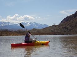
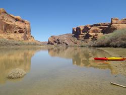
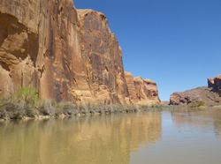
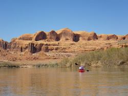
My wife and I were now headed home travelling through NE Arizona and SE Utah. We visited and hiked in beautiful places like Canyon DeChelly and Arches National Park. We realized that we had lost a little confidence as a result of our misadventure on the Verde and we were determined to regain our paddling mojo, so to speak. The solution: an easy day trip on the Colorado River near Moab, Utah. We had a blast paddling 12 miles on a fast but rapids-free stretch of the river [well above its confluence with the Green River where it becomes one of the premier white-water destinations in the world]. We floated through slickrock canyons and past cliff faces covered with Native American petroglyphs. We watched eagles, pelicans, cranes, etc. We felt one with the river [which is a feeling I often experience right here at home after a day on the Paw Paw].
I kept a friendly eye on the Colorado as we drove east following I-80 further and further up the valley that leads to the Rockies and the headwaters. Surprisingly, there wasn’t as much water in the river as I was expecting, given the fact of spring snow melt. In previous years, I had watched whitewater rafters as I drove along the highway, but now the upper part of the river just seemed low to me. I couldn’t understand why because we were far above the dams and reservoirs that supply Las Vegas with water. What was happening to the water that should be rushing down the upper Colorado? Turns out there is another inter-basin transfer occurring way up in the mountains on the Western Slope. Water is being diverted to a canal that crosses the Continental Divide and delivers it to Denver on the eastern side of the Rockies. Denver is located in the arid foothills and plains of central Colorado and is part of the Platte-Missouri-Mississippi watershed. Like Los Angeles, San Diego, Phoenix and Las Vegas, it cannot supply its own water needs without taking it from the Colorado. I was still ruminating on this phenomenon of the disappearing river when we got home to Michigan. When I logged on to Facebook, I learned from a group called American Rivers that the Colorado had just been declared the most endangered river in the U.S. Here is a link to their site, including a beautiful and poignant video about the Colorado: www.AmericanRivers.org/Colorado.
Anybody who has persevered to read all this should have a question at this point: What does this have to do with our local watersheds, the Black and Paw Paw Rivers? Personally, I believe there is a lesson here even for those of us lucky enough to live in a region with high quality fresh water resources. WE SHOULDN’T TAKE THEM FOR GRANTED! There are problems we have to solve and threats to be aware of right here at home. The biggest pollutant in our rivers is sediment from agricultural run-off. Inappropriate and uncontrolled development [with excessive impervious surfaces such as parking lots] lead to storm-water flowing directly into our rivers carrying oils and chemicals. Invasive species threaten biodiversity and the quality of habitat in the wetlands and floodplain forests. And there are certainly threats from industry of which we need to be vigilant. We should never forget the pipeline leak on the Kalamazoo River that contaminated miles of the river and closed a section of it to recreational use for years. And only last month there was a leak of “mildly radioactive” water into Lake Michigan at the Palisades nuclear plant near Covert in Van Buren County. It turns out that this was the 2nd leak of radioactive coolant in two years at this facility.
All of this raises a question: If well established technologies such as pipelines and nuclear plants can still catastrophically fail, what about untested new technology like fracking? The North Branch of the Black River drains southern Allegan County. The DNR has now opened state land there for the purpose of extracting oil and natural gas using the technique of hydraulic fracturing [fracking]. Is this safe? Reliable? Worth the risk to our ground water? Good questions. Two Rivers Coalition is sponsoring a forum on fracking at the Van Buren Conference Center in Lawrence on Wednesday, June 12 at 6:30 p.m. There will be 3 speakers representing industry, environmental and regulatory perspectives making presentations and taking questions. It behooves all of us who bemoan the fate of other watersheds to attend this forum and learn more about an important issue confronting our own watershed. It is worth remembering what John Wesley Powell said about watersheds, a place where “all living things are inextricably linked”.
Good points Kevin and glad to hear you were able to weather 30 years of storms prior to being dumped in the Verde. Seriously, glad you are OK.
Something else to note, it was illegal to collect rainwater off of your roof in Colorado (maybe in a few other western states also) since all the precipitation once it hits the ground became part of a watershed where the water rights are restricted for certain uses but after a study in 2007 in Douglas County (south Denver) found that 97% of the precipitation didn't reach a stream since most was taken up by plants or evaporated, the state legislature changed the law (2009) and now have a few pilot projects going on.
We are lucky here to currently have an abundance of fresh water. Lets hope it stays that way.
How about we let "corn" be an alternative to the purchase of foreign gas and oil and any other product that can be derived from crops grown in the USA?
