Home>Let It Flow
Let It Flow Blog
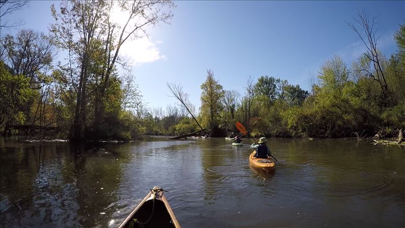
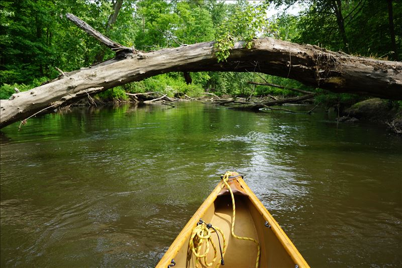
The Paw Paw River is a fantastic waterway to float a boat down but is known for its many downed trees that slow paddling progress and wear down paddlers from the repetitive climbing out of a boat and pulling it over tree fall. Even if you can get around or squeeze through a tree fall, it usually requires you to paddle back and forth across a river or to slowly make your way through a tangled twist of downed tree limbs. So why would anyone want to paddle 67 miles of the Paw Paw River from the city of Paw Paw to Benton Harbor in a single, very long trip? The simple answer is that some people just love a challenge and the Paw Paw River. I spent a weekend with a few of these people.
We launched from Maple Lake Dam in Paw Paw during the dark early morning hours at about 5:15 AM. Wearing headlamps we paddled away from the circulating currents below the dam and left the noise of the crashing water to enter an eerie silence. Too early for birds, the only sound was the strong winds pushing through the trees and the familiar sound of the paddle hitting and pulling through the quickly moving water. With recent storms, the river was flowing at a good pace, but fresh trees had fallen to slow progress. The USGS river level gage at Riverside was malfunctioning and stuck at 6.9 feet or 470 cfs.
Our three canoes (two tandems and one solo) and five paddlers quickly tuned into the rivers rhythm and focused on avoiding down trees while moving at a quick pace. With the aid of our head lamps, we made our way through the dark and downed trees for that first hour of paddling from Maple Lake to County Road 665. The birds began to sing as the sun came up and we approached County Road 665 Bridge. With the sun up and 2.5 miles behind me, a paddling pattern set in of scanning ahead for downed trees, finding a path through or over, listen to bird calls with a special ear for prothonotary warblers (each location was recorded), observing flowers and wildlife near the river’s edge, snacking to replenish calories spent, and staying hydrated.
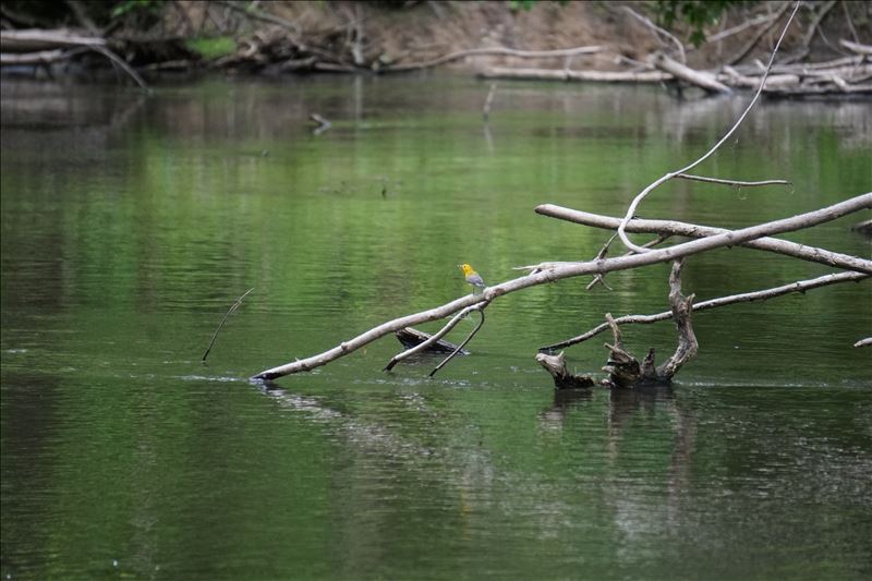
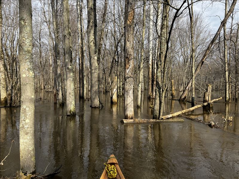
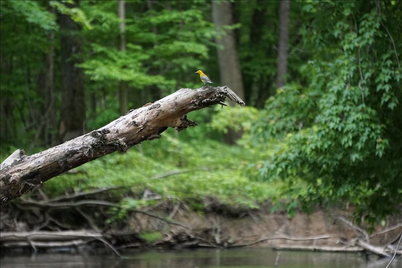
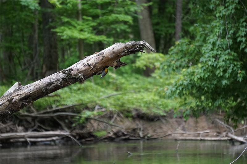
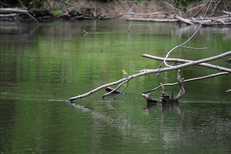
Mottled white sycamores and bark less dead ash reflected the early morning sun while the still water in the floodplain forests reflected the pockets of blue sky. I had to keep reminding myself that I had a long day ahead of me and needed to keep paddling and not be pulled into these magnetic habitats. Near these floodplain forests is where I would regularly hear and see the golden or prothonotary warbler. With its loud sweet, sweet, sweet call and bright golden head and body it was easy to find and record these birds during the trip. This data will be added to Two Rivers Coalition’s Prothonotary Warbler Partnership project to map their presence in the watershed and help understand our floodplain forests.
I recorded 70 prothonotary warblers in addition to many other small birds along with bald eagles, owls, several busy blue heron rookeries, turkey, otter, beaver, muskrats, woodchucks, coyotes, and racoons. During much of the paddling trip, I found myself chasing wood ducks and geese with their many babies in-tow racing downriver as they swam away from my approaching canoe. The baby ducklings and goslings would eventually find woody areas along the shore to hide while the adults would fake an injury and flap down river for me to follow.
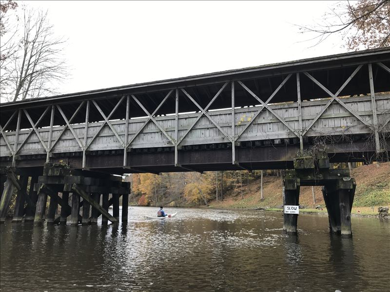
The roughly 23 bridges over this stretch of the river were milestones to meet and track progress. In the end the downed trees would wear us down and win, one canoe pulled out in Hartford (34 miles) which is about half the distance to Benton Harbor. A second canoe pulled out at the 70th Street Bridge about 41 miles on the river and the final canoe pulled out in Watervliet having spent about 15 hours covering 46 miles on the river.
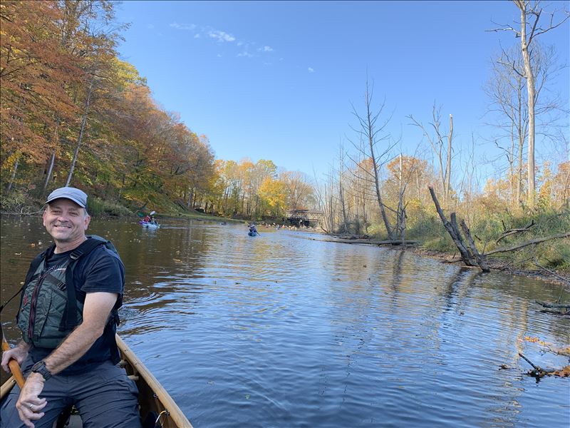
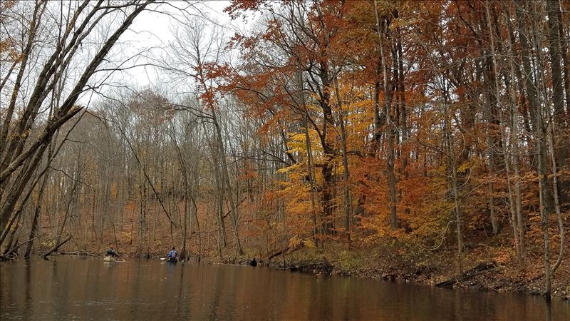
Spending that much time on the river lets you see a lot of the river over a relatively short period of time. It is a refreshing, rewarding, and challenging river to recreate on with much of its riparian habitat mostly intact. This habitat serves as an important wildlife refuge and corridor in a time of increasing habitat loss. There are some homes and farms near its edge at times, but for most of the trip the river winds though a forested escape with trees that stretch across the river providing a close, connected feel with this rich, riparian habitat.
Unfortunately, zoning ordinances for riparian protections vary widely among the townships the river flows through and few meet water quality protection guidelines outlined by Michigan State University. We have conservation minded landowners, conservation groups like Sarett and SWMLC, city and county parks, DNR State Game Area, and the Pokagon Band of Potawatomi to thank for much of the undeveloped habitat hugging and protecting the Paw Paw River.
We may have come up short of our goal this time but left mentally recharged even if our bodies were worn down and with a greater appreciation of the Paw Paw River after a rewarding big day on its waters.
Check out a trip video made of short clips: You Tube Video Link
Two Rivers Coalition’s mission is to help conserve, educate and advocate for the Black and Paw Paw River Watersheds. One way we help meet this mission is by encouraging recreational paddling and by hosting paddling events on the Black and Paw Paw Rivers. Check out our paddling resource page to learn more. We like to think if we can get people to play on and in our rivers, they will become advocates for healthy rivers and watersheds. As they say, we protect only what we love and it’s easy to fall in love with the Paw Paw and Black Rivers.
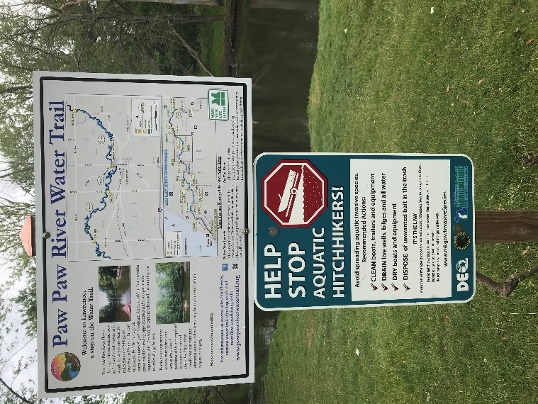
Two Rivers Coalition also helped create the Paw Paw River Water Trail which begins in the city of Paw Paw and follows the winding Paw Paw River some 60+ miles to the town of Benton Harbor ending as it joins the St Joseph River. The Black River is part of Michigan’s Heritage Water Trail program with recreational paddling sections near the town Bangor and then again closer to South Haven. In between is a woody “wilderness” section that is too congested with trees for recreational paddling. The Paw Paw River also has a section of waterway that is too congested with trees to paddle. This section is downstream of the 40th Street bridge and extends to the 46th Street bridge on the Paw Paw River.
In other parts of the water trails, a small path is cut through downed trees annually to help recreational paddlers enjoy the rivers without the need to constantly climb out of your boat. The cut path is generally about 4-6 feet wide to allow passage of boats while leaving most of the trees in the river. Trees that have fallen into the river play an important role in the overall health of the river and we want to leave as much as possible in the river while also allowing for recreational paddling. Trees provide crucial habitat in our rivers creating an array of micro habitats needed for many species of fish, aquatic and terrestrial insects, turtles, frogs, snakes, and birds to survive. This habitat heterogeneity helps maintain biodiversity throughout the river and its riparian corridor.
Water trail maintenance or path cutting occurs in late spring to early summer and is dependent on water levels, water temperatures and available funding. Maintaining this open water trail is challenging and not perfect as trees can fall shortly after a path is cut and water levels can impact whether a tree creates an obstruction to paddling or not. Higher water levels may allow passage over some submerged logs while preventing passage of trees hanging over the water’s surface. Low water levels generally create challenging paddling conditions as more submerged logs appear near the water’s surface.
Low water levels also allow gravel bars to emerge as paddling obstructions that need to be avoided or you will be walking your boat across them. Many of the gravel bars provide a refreshing break from your boat in the warmer summer months and allow for paddlers to explore the river closer. These gravel bars are great to cooling off during the warm summer months by sitting in the water and exploring the benthic environment which is home to many interesting insects, small fish, and freshwater mussels. Freshwater mussels are a fun species to look for and observe, but many are threatened or endangered so do not pick up and handle. Freshwater mussels play an important role in filtering out organic material from the river as well as add to the food web by providing food for other river animals. The Paw Paw River has about 17 species of freshwater mussels including the endangered Lilliput, the threatened Slippershell and several species of special concern such as Elktoe, Round pigtoe, Ellipse and Rainbow. Learn more about Michigan's Mussels.
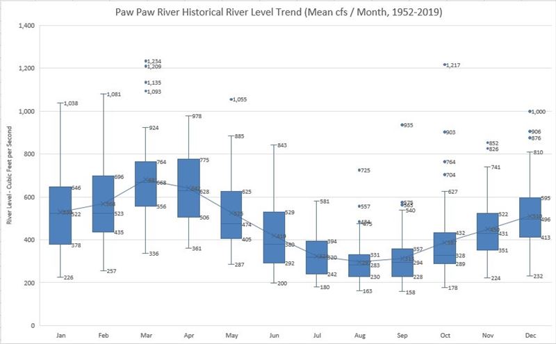
Much of the Paw Paw River retains its natural hydrology with water levels rising and falling slowly depending on rain fall and ground water outflow. A USGS streamflow gage is located near the town of Riverside and provides a way of checking on the river water levels. The chart included shows the average monthly streamflow in cubic feet per second from 1952-2019 and highlights the seasonal cycle of water levels. The highest mean water levels are found in early spring while the lowest mean levels are found in the middle to late summer. The river’s intact natural hydrology allows the river to follow a meandering path with many bends and some occasional oxbows. Its ecologically important unfragmented floodplain forest allows the river to expand as water levels increase and overflow its low-lying banks moving nutrients and sediments further inland while reducing rapid changes (flashy) in water levels. The Black River’s water levels are flashier than the Paw Paw River’s due to its historically altered hydrology.
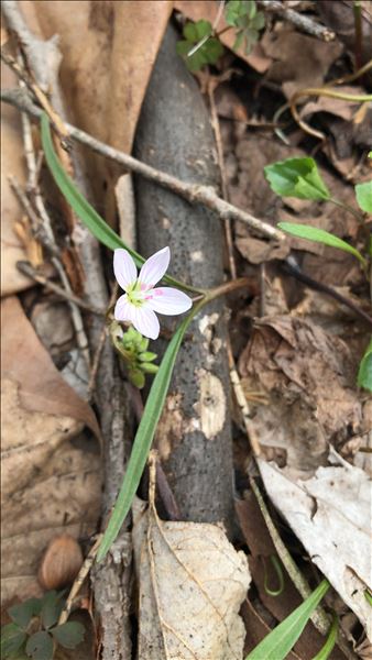
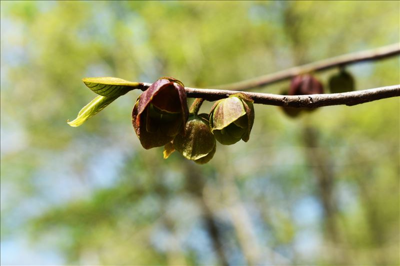
The Paw Paw River’s floodplain forest play an important role in harboring biodiversity as well as providing recreational paddlers pleasant stretches of protected riparian. Paddling the Paw Paw River through these nearly closed canopy floodplain forest that extend over the river is one of the true treats for our recreational river paddlers. The rivers riparian can be dotted with spring ephemeral flowers like trillium, geranium, and spring beauties in the spring to cardinal flowers, swamp mallow and many types of asters in the later seasons. Toss in the flowering trees and shrubs like dogwoods, service berries, ninebark, catalpa, cherry, and its namesake paw paw and one can rarely paddle the river without something in bloom.
The watershed’s healthy floodplain forests are home and short-term refueling refuge to many birds. It is not uncommon to hear or see 30+ species on a few hours paddle trip. One of the more notable birds is the state special concern prothonotary warbler which acts as an indicator species of healthy floodplain forest. Two Rivers Coalition started a partnership with these warblers in 2020 to help map out where they are using the river and thus where we might find the best remaining floodplain forest habitat. Healthy floodplain forests harbor many other flora and fauna including frogs, turtles, snakes, bats, and many mammals some of which are rare and threatened. They also play important roles in maintaining water quality and reducing downstream flooding in more developed areas.
As smaller recreational rivers, the Paw Paw and Black Rivers offer a more intimate river experience for paddlers but in exchange it also adds more challenges. The more intimate river experience can be very rewarding as paddlers get an up-close emersion of the river’s riparian habitats and its biodiversity along with its clear waters showing the changing benthic environments just beneath the boat. The woody debris adds an element of habitat heterogeneity where common water snakes and northern map turtles bask in the sun as you float within arm’s reach. To fully enjoy this more intimate river experience with the added challenges you need to be able to maneuver your boat easily through the trees and shallow gravel bars.
I find the work and paddling skills needed to maneuver effortlessly through the trees, over the shallow gravel bars and around the many river bends adds to the pleasure of paddling the Paw Paw River. It is not a river for effortless floating with a drink in hand as I have seen many times on rivers in Michigan. In many ways, the Paw Paw River is a great river for those who enjoy the art and skill of paddling while also soaking up the scenic beauty of a natural river and its mostly untouched riparian and thriving biodiversity. It is a river that changes character nearly every time you paddle it as its water levels naturally ebb and flow and the flora and fauna live out their seasonal life cycles.
There are a handful of details to consider when deciding to become a regular Paw Paw and Black River paddler. Some of these details center around your boat and its design while others on your skills and abilities. Because of the many meanders and tree falls, maneuverability of your boat is very important (if not the most important). It is not uncommon to have to maneuver your boat from one bank to the other and back in a very short distance all the while trying to line up for small slots in cut trees and avoiding overhanging branches with spider webs (if those creep you out). A longer boat in general will make this more challenging while a shorter boat less challenging. Also, a boat with more rocker or curve along the bottom or hull will make maneuvering easier. The tradeoff for a shorter, more curved or rockered boat is that it requires more effort and skill to paddle straight.
A narrower boat with less height or depth may also be of benefit in maneuvering through the tree falls where gaps between trees and water surface as well as cut paths can be small and always changing. The trade-offs here are possibly a less stable boat and risk of water entry over the sides. If you are kayaking, you are likely using a double-bladed kayak paddle while in a canoe you are likely using a single bladed canoe paddle. A longer kayak paddle can make boat control easier but may also be difficult to use in amongst the tree falls where a single bladed canoe paddle is less encumbered. A composite kayak or canoe can readily slide over slightly submerged trees but may also be at a greater risk of damaging the hull. A plastic kayak is less likely to be damaged but also offers a little more resistance when paddling over a slightly submerged tree. Composite boats are also lighter in weight than plastic boats which may allow for easier pulling / lifting over logs that can’t be paddled around. Getting in and out of a canoe to climb onto a tree fall and pull your boat over is much easier than a kayak for many of us older paddlers.
There are always tradeoffs when choosing a boat and paddle. It has been said that there is no such thing as a perfect boat, however I would argue that a well-made 14-foot (or maybe 12) solo canoe in the hands of an avid paddler is an ideal boat for the Paw Paw and Black Rivers. Most 14-foot solo canoes are about 30 inches wide and 12-14 inches in depth with a moderate amount of rocker. When leaning the canoe, you can create more rocker to ease maneuvering for quick turning (you can also do this with some kayaks with a skirt on). A skilled paddler can paddle forward with minimal turning using appropriate corrections to overcome the boats rocker when on the river’s straight aways and leverage the rocker during the many bends and maneuvering around trees.
The solo canoes shallow depth and narrow width make getting the canoe through the trees easier than wider, deeper boats. With a wide, short single bladed paddle (50-52 inches) you can get a good grip on the water while minimizing digging into the river bottom or its submerged trees while also avoiding overhanging trees. Overtime, a solo canoe paddler can learn and leverage an array of paddling strokes including draws, prys, Cs and Js in combination with boat and body position to skillfully maneuver a canoe through some of the most challenging tree falls all the while enjoying every bit of it. With time you will seek out the more challenging conditions to improve your paddling skills and fun on the river.
It is worth noting that one of the more popular and stable ways to paddle a solo canoe is with knees on a pad and butt on the seat. Some find their knees or ankles cannot sustain that position for long lengths of time, thus a solo canoe may not for everyone. A shorter kayak is also a suitable boat and many now prefer the stand-up paddle boards. However, a short solo canoe with a single bladed paddle is often overlooked as a paddling option and maybe the ideal boat for those who prefer the rewarding challenges of the Paw Paw and Black River’s intimate paddling experiences.
In the end we want you to enjoy your time on the Paw Paw and Black Rivers, seek to become a better paddler, and desire to learn more about these rivers and what makes them special. Fall in love with the Paw Paw and Black Rivers as they both need more friends and advocates.
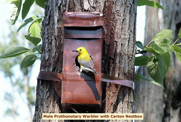
In the late 1990’s my wife and I were paddling a winding water trail on the Cache River in southern Illinois when we noticed a bright yellow bird landing on a milk carton nest box mounted to a tree along the river’s edge. This was the first time I can recall seeing a prothonotary warbler and it made a memorable impression that I have not forgotten, even after many of the details from that trip have faded away. After several hours on the river, we had many more prothonotary warbler sightings as these milk cartons were scattered along the winding water trail to encourage nesting of this cavity nesting warbler (one of only two warblers that use nest cavities). We began to recognize its loud piercing sweet-sweet-sweet… (5-12 times) calls as we paddled the Cache River with these beautiful birds.
Fast forward to 2020 and I was paddling solo down the Paw Paw River when I noticed a brightly colored prothonotary warbler using a cavity in an old, dead tree over hanging the river. My mind immediately went to the Cache River, its milk carton nest boxes, and my overall enjoyment of that experience from so long ago. In the past 10-15 years I have paddled all the Paw Paw River, the Kalamazoo River, and many other rivers in southwest Michigan. In all those paddle trips, I could not remember seeing a prothonotary warbler before that day on the Paw Paw River which seemed odd.
After some research, I found that these warblers are only found in healthy floodplain forest or wooded swamps. The warblers are not abundant in Michigan as it is in the upper limit of their breeding range. They are also only present along Michigan’s rivers during the breeding season from about April through July. Maybe after all that paddling in southwest Michigan, I had just not been lucky enough to check all the necessary boxes. Never-the-less, being a volunteer lead paddler for events at Two Rivers Coalition, I began to develop a plan to try and recreate my Cache River experience for paddlers of the Paw Paw River.
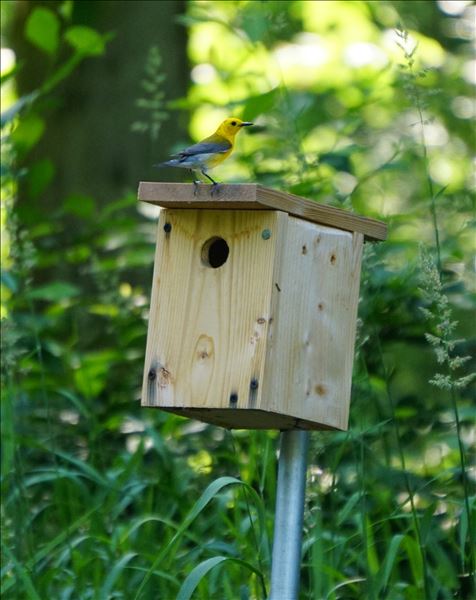
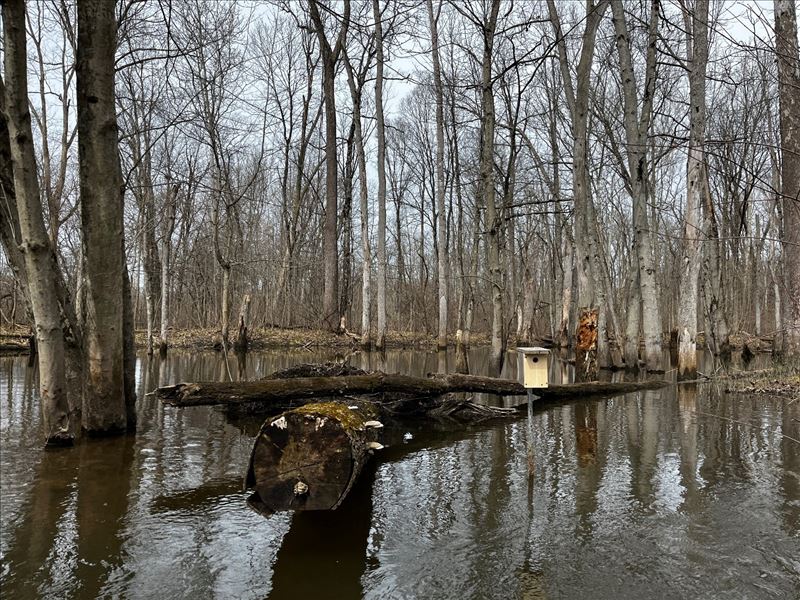
Two Rivers Coalition has a mission to conserve, educate and advocate for the Paw Paw and Black River Watersheds and providing paddling events where we seek out and show the public these beautiful birds seemed like a fun and rewarding paddling experience. Not only would we get to enjoy the river with the public, we would get to show them one of its more colorful inhabitants. To make it more reliable and easier to find the prothonotary warbler, we would create some nest boxes and mount them in areas with prothonotary warblers. Then each season we could lead a paddling event to the nest boxes for everyone to see, hear and just simply enjoy these amazing warblers learning a little bit about this resident warbler.
Unfortunately, after two years, we have yet to get a prothonotary warbler to nest in our man-made boxes. We have had some trial and error on nest box placement and entry hole size, but we continue to work toward a successful nesting. In that time frame, I have done more reading about these warblers and learned that they are considered indicator species for healthy floodplain forest. Their presence in the Paw Paw River Watershed was telling us that we had healthy floodplain forest. I got to thinking that this could be useful in allowing Two Rivers Coalition to monitor and better understand where some of the healthiest parts of the watershed are, where protection is needed, and where restoration efforts might help.
With that our partnership with the prothonotary warbler further developed beyond the paddling event. It has taken on another promising phase as we want to better understand how these warblers can help us in our monitoring of the watersheds. By asking for the public to participate in community science to look for these warblers during the breeding season and recording their observations in eBird, we can as a community create more accurate maps of their presence which helps us understand the underlining habitat. The prothonotary warbler is a species of special concern in Michigan and is included in the state’s Wildlife Action Plan Species of Greatest Conservation Need List. The community science data could be used to potentially support conservation efforts in our watersheds given the importance of this warbler.
That is more or less how the Two Rivers Coalition prothonotary warbler partnership started and continues to evolved. The partnership is akin to the river it started on with its many meanders mirroring our learnings as we proceed to better understand this partnership. During my studies of the prothonotary warbler, I learned that my original encounter with them on the Cache River with the milk cartons was part of a study lead by Jeff Hoover. His studies provided data to support the indicator species status of the prothonotary warbler regarding floodplain forest. Listed below are some of the take aways from Hoover, Jeffrey P. 2009. “Prothonotary Warblers as Indicators of Hydrological Conditions in Bottomland Forests.” In Proceedings of the Fourth International Partners in Flight Conference: Tundra to Tropics, edited by Terrell D. Rich, Coro Arizmendi, Dean W. Demarest, and Craig Thompson, 128–137. Partners in Flight.
- Indicator species provide important information on habitat quality and the ecological integrity of ecosystems. Indicator species have been studied to sound the alarm when ecosystems are degraded or threatened, but they also may be used to measure the success of habitat management and conservation activities.
- There are a number of characteristics that add to the value of a species as an indicator. These characteristics include providing an early warning of habitat degradation or loss of ecosystem integrity, indicating the cause of the problem and not just that a problem exists, providing assessment over a wide range and intensity of degradation, and being cost-effective to monitor and relatively easy to study. In addition, an indicator species may be particularly useful if it is emblematic of, or strongly associated with, a particular habitat, tightly linked to ecosystem processes, and representative of how other ecologically similar species are being affected. Even though indicator species have been used to sound the alarm when ecosystems are degraded or threatened, they also may be used to measure the success of habitat management and conservation activities.
- Prothonotary Warblers (Protonotaria citrea) preferentially breed in forested wetlands in the eastern half of the U.S. and are therefore an emblematic species of bottomland forest ecosystems. Prothonotary Warblers prefer to nest over water, a preference thought to be associated with food (i.e., insect) availability and selective pressure from terrestrial nest predators (e.g., raccoons). Therefore, these warblers are threatened not only by habitat loss and habitat fragmentation, but also by the channelization of streams and the subsequent cascade of events that degrade hydrological processes associated with off-channel forested wetlands.
- Habitat specificity, a tight link to hydrological processes, and the fact that they can be studied in great detail during the breeding season make Prothonotary Warblers well-suited to be an indicator species.
- The interplay of topography and hydrology creates and maintains habitat complexity and promotes high levels of biodiversity. Intact bottomland forest ecosystems are important habitats for many species of bird and are especially valuable because they support a high diversity and density of breeding Neotropical migratory birds.
- The number of Prothonotary Warblers using particular forested wetlands can vary dramatically across years in association with hydrological processes. Warbler densities increased or were maintained at high levels in forested wetlands where hydrological processes had been either restored or not degraded. This positive effect of hydrological conditions on the density of warblers is the result of a chain of events that begins with forested wetlands retaining their water for much of the breeding season (April-July). The presence of relatively deep water in these “higher-quality” wetlands leads to decreased rates of nest predation which, in turn, lead to increased productivity. The more successful prothonotary warblers are, the more likely they are to return to the same breeding location the following year.
- The results from my research on Prothonotary Warblers support the conclusion that conservation practices that conserve or restore the integrity of forested wetlands, are benefiting local populations of breeding birds. Habitats that promote low or reduced rates of nest predation and high annual fecundity, such as the deeper-water areas of forested wetlands, are important to local population dynamics and may be critical to the maintenance of populations over larger geographic scales.
In another study, Cooper and others (2009) reported that, “the nature of the responses shown by prothonotary warblers to anthropogenic and natural perturbations suggests that this species can serve a valuable role as an indicator of floodplain forest ecosystem integrity. Usually abundant in functioning floodplain forests, this species is less common in floodplain forests that do not flood regularly due to altered hydroperiod. Prothonotary warblers were largely unaffected by timber harvests designed to mimic natural disturbances but were influenced by both the presence and timing of flooding, an integral ecological process in these ecosystems, and fragmentation which exposes interior forest birds to brood parasites.”
As Two Rivers Coalition enters its third year of this partnership, we are excited to learn more about these emblematic floodplain forest warblers and how they can help us meet our goals of conservation, education, and advocacy of these watersheds. We hope that this is the year that we get warblers to use our man-made nest boxes and that we get the opportunity to share this experience with the public to educate them about this important indicator species of healthy floodplain forest. Even without a successful nesting we know paddlers are seeing the nest boxes, asking questions about them, and in the end learning about these warblers and hopefully the habitat they need to survive. Educating and advocating for these watersheds is what Two Rivers Coalition aspires to do and we think this is a good opportunity for that work. We also want to help conserve the ecologically important habitat in our watersheds and hope we can add to the eBird database to show where these species of special concern are using the wetland forests in the Paw Paw and Black River watersheds. By further documenting where these warblers are present in the watershed, we hope that can lead to further conservation efforts benefiting the warblers and the overall watershed. Please joins us in the partnership.
Additional Resources:
- Columbus Audubon: The 2009 Quest for Nesting Prothonotary Warblers – Columbus Audubon
- Cooper, R.J., Wood, L.A., Gannon, J.J. et al. Effects of timber harvest and other factors on a floodplain forest indicator species, the prothonotary warbler. Wetlands 29, 574–585 (2009). https://doi.org/10.1672/08-139.1
- The Cerulean, Summer 2016: Cerulean-Summer-2016.pdf (ohiobirds.org)
- EBird: Prothonotary Warbler – eBird
- EPA Healthy Watersheds: Healthy Watersheds Protection | US EPA
- Going for the Gold Presentation: Going for the Gold Three Decades of Prothonotary Warbler Husbandry by Dan Best and Rachel McKinney – YouTube
- Hoover, Jeffrey P. 2009. “Prothonotary Warblers as Indicators of Hydrological Conditions in Bottomland Forests.” In Proceedings of the Fourth International Partners in Flight Conference: Tundra to Tropics, edited by Terrell D. Rich, Coro Arizmendi, Dean W. Demarest, and Craig Thompson, 128–137. Partners in Flight.
- Michigan Natural Features Inventory (MNFI): Protonotaria citrea (Prothonotary warbler) - Michigan Natural Features Inventory (msu.edu)
- NestWatch: NestWatch | Prothonotary Warbler – NestWatch
- Nature Serve: Protonotaria citrea | NatureServe Explorer
- Peoria Audubon, Dr. Jeff Hoover: Peoria Audubon Society - Jeff Hoover: Warbler Research
- Sialis: All About Prothonotary Warblers - species bio (sialis.org)
- Dr Christopher Tonra: The Tonra Lab of Avian Ecology - Home (christophertonra.com)
- Two Rivers Coalition: Two Rivers Coalition: An Alliance of the Black River and Paw Paw River Watersheds
- Lawrence Walkinshaw, Nesting Studies of the Prothonotary Warbler: Nesting Studies of the Prothonotary Warbler on JSTOR
 After my last blog, I promised myself that I would not write anything else about climate change for a while [the whole beating-a-dead-horse thing]. But then I went and did something silly; I attended TRC’s 5th Annual Meeting where Peter Sinclair was the featured speaker. He has now spoken twice at TRC events and, for my money he is one of the most persuasive speakers out there on the subject of climate change. Contrary to the headline that The Paw Paw Courier-Leader ran, he is NOT a climate skeptic. In fact, his main claim to fame is his website called “Climate Denial Crock of the Week” at climatecrocks.com. Sinclair makes it his business to consult with scientists in various fields and then uses their research to refute unscientific assertions that there is no such thing as human influenced global climate change. One of the things I really like about Sinclair’s approach is that he readily admits that he has no expertise in climate science and that he relies on experts in the fields of climatology, physics, oceanography, meteorology, glaciology, etc. for his information. What Sinclair is really good at is taking complex scientific information and presenting that data in a format that even a lay person like me can understand. Watching his presentation is a little like watching the film, “An Inconvenient Truth” without the slick Hollywood feel [and Al Gore baggage].
Sinclair spent part of last summer in Greenland with scientists attempting to assess and measure the loss of ice on the world’s second biggest ice 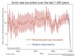 sheet. He presented video footage shot from an airplane showing the surface of the Greenland ice sheet riddled with melt-water streams that appear to be slowly eroding the core of the mile thick ice sheet. Even more riveting were his maps showing the extent of the thinning of permanent sea ice on the Arctic Ocean over the last 30 years. Basically, most of the old, thick ice at the North Pole is gone and only a thin remnant remains. It seems inevitable that in the next few years there will be an open water summer in the Arctic. This will likely have a disproportionate effect on global temperatures because ice reflects more sunlight [and heat] while open water reflects less sunlight and absorbs much more heat. Already a tremendous amount of energy is being trapped by greenhouse gases [primarily carbon dioxide] and reflected back to the surface of the planet. The quantity is staggering: the equivalent of 400,000 Hiroshima size nuclear explosions every day. And 93% of this increased energy is being absorbed by our oceans. Combine this with the increased acidity of the oceans due to CO2 uptake and it is no wonder that coral reefs are dying all around the world.
Now if you are like me, you probably assume that climate change is something that is going to happen to somebody else…somebody who wasn’t so lucky as to have ancestors who settled near the shores of the greatest freshwater system in the world [and far away from rising oceans]. Unfortunately for my peace of mind, TRC had asked Sinclair to speak specifically about potential effects of climate change here in Michigan and one of his graphs was unforgettable. 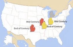 To illustrate the point that climate change will make Michigan both hotter and drier in the future, he gradually moved an image of Michigan south and west superimposed on a map of the U.S. If we immediately start making significant changes in the amount of greenhouse gases released into the atmosphere, Michigan shifts down to somewhere between Illinois and Indiana by mid-century and further south to Missouri by the end of the 21st century. That is best case scenario. If we continue the business-as-usual model with no efforts to reduce carbon emissions, Michigan is between Missouri and Arkansas by mid-century and ends up in North Texas by century end. The room full of people became very silent as everyone contemplated a summer where every day was in the 90’s with high humidity. I was remembering the heat wave that greeted me in July 2012 when I returned home after a year in China and tried to wrap my head around weather like that as the norm.
But then Sinclair said something that really grabbed my attention. He started talking about the failure of the fruit crop here in Michigan in 2012. He began by asking us old-timers if we could remember warm days in March when the breeze came out of the South, there was the first hint of spring in the air, girls would go outside wearing shorts and halter-tops, and boys would follow them appreciatively. Then he reminded us what always happened next: after a warm day or two, the wind would shift around and come out of the North, it would get damn cold, and girls would put their thick sweaters and long pants back on. But in March of 2012 something extraordinary happened in Michigan. It didn’t warm up a little for a day or two; it got hot and stayed that way for a couple weeks. Of course we know the rest of the story: the fruit trees were tricked into blooming early and then, finally, the weather changed and there was a killing frost of record proportions in terms of the loss of cherries, apples, peaches, grapes, you name it. However, what he said next was news to me; at the same time Michigan was setting all-time highs for March temperatures, Arizona and New Mexico were setting records for low temperatures and high amounts of snowfall. Are these just perverse anomalies or is there a link to global climate change? Sinclair persuasively makes the case for the link and its name is the jet stream.
 We all think we know something about the jet stream: it blows from west to east very high in the atmosphere and is the reason you can fly from L.A. to New York quicker than you can make the return trip. More importantly, the jet stream is why most of our weather patterns on the North American continent move from west to east. What powers the jet stream is the huge temperature difference between the cold air mass over the frigid Arctic and the warm air mass over the equatorial region. So what happens when the Arctic air mass isn’t quite as cold as usual? There is less of a temperature differential between the north and south and the jet stream weakens. Instead of blowing fast and relatively straight through the upper atmosphere, it slows down and starts to make huge sweeping turns north and south through the continent. Sinclair showed some maps of the jet stream in 2012 and it resembled a map of the Paw Paw River with huge meanders. These snaking bends or “kinks” can cause weather systems to become trapped in place and remain virtually stationary for weeks at a time. So in March 2012, the northern bend of the jet stream stalled over Michigan allowing a mass of warm air from the Gulf of Mexico to sit here for weeks dooming our fruit crop. At the same time, the southern bend was over Arizona allowing an Arctic air mass to stall there dumping snow for weeks.
Was this a mere statistical outlier, a one-time phenomenon never to be repeated? Sinclair says these kinks in the jet stream causing extreme weather systems to stall and remain stationary appear to be happening more often. He showed pictures of Pakistan in August 2010 when the worst monsoon season ever caused flooding so severe that 25% of the population was homeless at one time. At the same time, Russia was having its worst heat wave ever. Listening to Sinclair, I thought back to the horrible heat wave and drought in the summer of 2012 when it seemed as if the weather was never going to change. Maybe stalled weather systems caused by a weakened jet stream are the new normal. And how much worse may it get if the Arctic becomes ice free in the summer?
 Sinclair’s message couldn’t be clearer: global climate change isn’t just happening to unlucky people living at sea level on the Maldive Islands. And it’s not just something that our grandkids will have to deal with in a few decades; its effects are already present and will certainly become even more pronounced in our lifetimes.
Post Script: I wrote this blog back in December, before the Great Blizzard of January 2014. Since I was snowed in for days at the end of my quarter mile driveway, I had a lot of time to contemplate the two feet of snow, howling winds, and below zero temperatures. At first I thought it was just a blizzard, the kind that I remembered from childhood. For instance, I remember back in 1967 my dad pulled me on a toboggan through the drifts from married housing at W.M.U. to the grocery store and back. In 1978, I was a student at Kalamazoo College and we couldn’t even get out of the dorm to the cafeteria for a day. Back to the present, all the weather forecasters were talking about the polar vortex. What they meant was that a great circulating mass of frigid polar air had left the Arctic region and headed south into Canada and the U.S. Normally, this mass of frigid air stays at the North Pole trapped there by fierce jet stream winds. But in January 2014, those winds were weak enough for the polar air mass to break out. In fact, the polar air mass split into two pieces, heading into North America and Eurasia respectively. According to the magazine “New Scientist”, our polar vortex blizzard was a result of weakened jet stream winds. Perhaps you can’t prove beyond a shadow of a doubt that this weather event was directly caused by global warming, but it sure seems plausible.
Meanwhile, California is having its worst drought in over 100 years. Only a scant amount of precipitation has fallen [as either rain or snow] over the last 14 months. The meteorologists all agree that the reason for this is an unusual high pressure system over the Pacific Ocean that is blocking the normal track of winter storms which usually bring rain to the coast and huge amounts of snow to the Sierra Nevada Mountains. This high pressure system has stalled over the Pacific for so long that some fear it may be become a semi-permanent feature. Some California farmers are already letting their fields lay fallow this year, while fruit and nut farmers are desperately trying to pump more water out of the aquifers. Stay tuned as this climate crisis unfolds.
Bottom line: The new normal seems to be the possibility of extreme weather [heat, cold, wind, rain, snow] and stalled weather systems at any time and any place.
 Post Post Script: Recently I attended lectures by environmental activists Bill McKibben of 350.org and Winona LaDuke of HonorEarth.org. They both mentioned the three numbers that every thinking person should know. The first number is 2 degrees C. This is the most widely accepted figure for the absolute maximum rise in global temperature that is possible without triggering complete climate chaos. The average global temperature has already risen .8 degrees C. over the last century. More significantly, there is already enough excess heat in the oceans to raise the temperature another .8 degrees C. In other words, we have already used up 1.6 degrees of our potential 2 degree budget.
The second number is 565 gigatons. This is the amount of carbon [oil, coal, natural gas] that, if burned, will raise the global temperature past the threshold increase of 2 degrees C. Turns out that we will burn this much carbon in approximately 15 years at the current rate.
The third number is 2795 gigatons. This is the amount of carbon in already discovered and proven reserves owned by the big energy companies and certain oil states [like Venezuela]. Not only are these reserves owned, they are also on the books as assets in the sense that the reserves are factored into the share price of stock in the big energy companies. I don’t know about you, but I find it truly frightening that we are planning to burn 5 times more carbon than what it will take to push the human race into oblivion. Have a nice day!
